

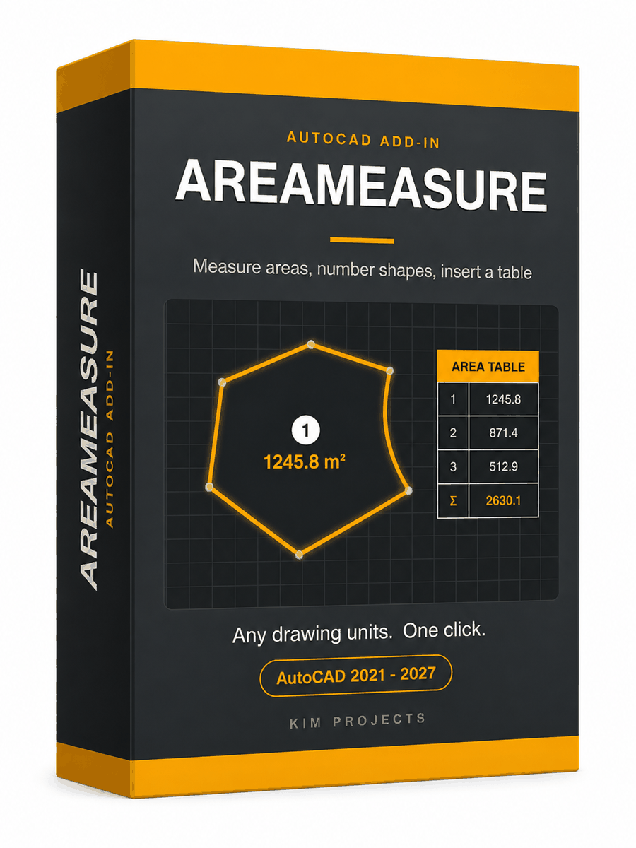
Area Measure Autocad Add-on
Measures closed shapes, numbers them and inserts an area table, with full unit control.
AutoCAD 2021–2027. One code activates one computer, permanently — no subscription.
Ver em português · IT · TR · Auf Deutsch · Voir en français · Ver en español
Description
AreaMeasure is a multi-units AutoCAD add-on that measures the area of every closed shape you select — polylines, circles, ellipses, splines — labels each area on the drawing, numbers the shapes, and inserts an AutoCAD area table with the total at the bottom. Room areas, plots, parcels, irrigation zones: one selection, one click.
No matter which drawing units your drawing uses, the output can be in any area unit you choose — measure a plot drawn in metres and report it in dunam, hectares or acres. Surveyors, architects, engineers and irrigation designers have used AreaMeasure since 2015; version 2 is a complete rewrite of that tool.
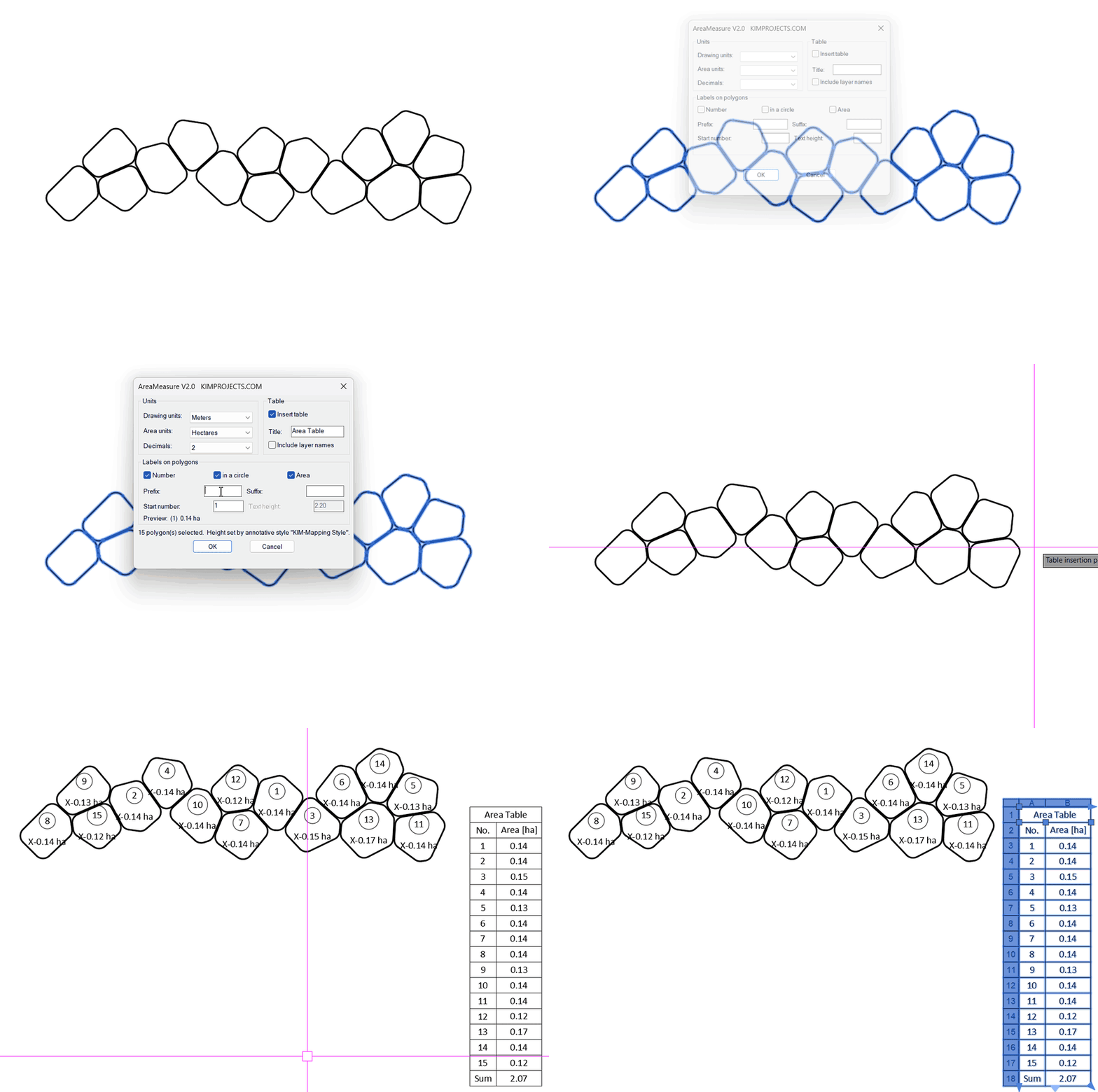
- A live preview in the dialog shows the label exactly as it will be drawn — using the real area of the first polygon you selected.
- Add your own prefix and suffix to the area label.
- The table is a real AutoCAD table — edit any cell, drag the column grips, export it with TABLEEXPORT.
- The table title is yours to write — “Area Table”, a project name, or leave it out.
- Annotative text styles are fully supported.
- Installs and loads natively on AutoCAD 2021 to 2027. No patch needed.

Why plain AutoCAD makes this slow
AutoCAD can tell you an area — AREA, LIST, the Properties palette, Quick Measure — but only one object at a time, and nothing is written on the drawing. A FIELD label can show one shape’s area, but you create and place it shape by shape, format each one, and there is still no numbering and no total. AreaMeasure does the whole job from a single selection: every shape gets its number and area label, and one totalled table lands where you point.
What it draws
- A number at the centre of every polygon — inside a circle balloon, or plain if you prefer. Numbering starts from any number you choose and counts up in ones (start at 5 and the polygons are numbered 5, 6, 7, 8…). An unclosed polygon is reported and skipped, never measured wrongly.
- The area label at the centre, in the area unit and decimal precision you chose.
- One area table: a title row, a No. column, an optional Layer column, the area of every polygon, and a Sum row with the total. You pick where it goes.
- Everything lands on its own layers (
AREA_LABELS,AREA_TABLE) and is a single undo step.
Any units in, any units out
Drawing units and area units are chosen separately, so the drawing never has to match the report:
| Drawing units | Millimetres, centimetres, metres, kilometres, inches, feet, survey feet, yards |
| Area units (output) | Ares, dunam, hectares, mm², cm², m², km², in², ft², yd², acres |
| Precision | 0 to 4 decimal places, your choice |

Your own prefix and suffix
Two small boxes in the dialog wrap the area label with your own text. Type XYZ- as the prefix and -room as the suffix, and a label that would read 1245.80 m² is drawn as XYZ-1245.80 m²-room. Leave both empty for a plain label. The unit itself is always part of the label, so a value can never be misread.
Annotative or not — your text style rules
AreaMeasure writes the labels and the table in your current text style. If that style is annotative, the text takes the style’s paper height and scales automatically with the annotation scale — the height box in the dialog locks and shows the style’s value, so nothing can disagree. With a regular (non-annotative) style you simply type the text height you want, and a fixed-height style offers its own height as the default.
How it works
- Type
AREAMEASURE, or click Area Measure on the Add-ins ribbon tab. - Select the closed polygons — as many as you like.
- Choose units, labels, numbering and table options. The preview line shows the label as you type.
- Press OK and pick the table’s corner. Done — in one undo step.
Good to know
| Works on | Closed polylines, circles, ellipses, splines and regions — regular or irregular |
| The table | A native AutoCAD table — edit it, restyle it, export it with TABLEEXPORT (CSV, opens straight in Excel) |
| Label placement | At the true centroid of each polygon |
| Undo | The whole output is a single undo step |
| AutoCAD | 2021, 2022, 2023, 2024, 2025, 2026, 2027 — 64-bit Windows |
| Command | AREAMEASURE |
When you purchase AreaMeasure, you’ll receive an email with a download link and a unique license code to activate the program.
- One activation code activates one computer.
- No subscription, no expiry date, no renewal.
- After activation the add-in works offline and never contacts our server again.
If you have questions about measuring areas in AutoCAD with our tool, contact us.
Reviews
There are no reviews yet.